Surveying & Site Measurements
High-Precision Digital Land Surveying, Contour Mapping & Boundary Demarcation
- Topographic & Contour Surveys
- Total Station & GPS Boundary Demarcation
- Volumetric & Earthwork Calculations

Accurate Geospatial Data to Anchor Your Construction Planning
Hindustan Projects provides high-precision digital land surveying and site measurement services across Bhilwara and Rajasthan. Commencing architectural planning or construction without verified topographical data invites serious risks: boundary disputes with neighbors, unexpected earthwork costs, improper plinth levels, and chronic drainage issues.
Utilizing electronic Total Station equipment and digital GPS positioning instruments, our engineering surveyors map legal property boundaries, elevation spot levels, and natural contour gradients. We deliver clean, millimeter-accurate digital terrain data that gives property owners, developers, and architects complete confidence before ground is broken.
Core Engineering Capabilities
Delivering disciplined craftsmanship and technical precision across every project phase.
Topographic & Contour Surveys
Mapping surface elevation variations, natural slope gradients, spot levels, and contours at specified intervals across your plot. This critical data guides building plinth heights, foundation step designs, and natural gravity-based stormwater runoff planning.
- Spot level mapping relative to permanent municipal road benchmarks
- Detailed contour elevation intervals identifying low-lying depression zones
- Location mapping of existing physical features including utility poles, trees, and adjoining walls
Total Station & GPS Boundary Demarcation
Pinpointing legal perimeter boundaries, corner angles, road centerlines, and municipal setback offsets with electronic digital accuracy. We eliminate ambiguous tape measurements, providing clear on-ground pegging that secures your property lines.
- Precision coordinate recording tied to permanent physical reference points
- Verification of on-ground boundary dimensions against title deed measurements
- Corner coordinate tables preventing encroachment and boundary ambiguity

Volumetric & Earthwork Calculations
Calculating precise cut-and-fill quantities for plot leveling, basement excavations, and foundation trenches. Our digital 3D terrain models provide verifiable earthwork volume figures, preventing contractor over-billing on excavation and soil transport.
- Pre-excavation baseline ground level recording across a dense grid
- Mathematical cut-and-fill volume computation for site grading and leveling
- Transparent volume audit sheets supporting fair earthwork contractor billing

Surveying Scenarios We Support
Pre-Purchase & Pre-Design Plot Validation
Verifying actual physical plot dimensions and road frontage before purchasing land or commissioning architectural floor plans.
Residential Plots & Large Farmhouses
Establishing natural drainage slopes, driveway grades, and perimeter fencing lines across undulating residential acreages.
Industrial & Factory Campuses
Grid leveling, heavy machinery foundation leveling, and internal roadway alignment across multi-acre industrial plots.
Our Digital Surveying Process
Benchmark Establishment
Establishing stable temporary benchmarks (TBM) tied to permanent local road crowns or physical landmarks.
Digital Field Data Capture
Capturing boundary corners, spot levels, existing structures, and utility alignments using electronic Total Station instruments.
Coordinate Geometry Processing
Processing raw field observations through coordinate geometry software to verify mathematical polygon closure accuracy.
Contour & Terrain Modeling
Interpolating elevation points into digital contour models highlighting natural surface gradients and drainage channels.
CAD Drawing Delivery & Pegging
Issuing complete CAD drawings with coordinate tables alongside physical on-ground corner pegging.
Confirmed Survey Deliverables
Every HiPRO engagement concludes with verified documentation, technical schedules, and physical deliverables.
Why HiPRO for Land Surveying
Civil Engineering Perspective
Because our core business includes construction, our surveyors understand exactly what data architects and civil engineers need to plan foundations and drainage.
Rapid Local Mobilization in Rajasthan
Based in Bhilwara, our survey crews mobilize quickly across residential plots, industrial corridors, and rural acreages in Rajasthan.
Digital Electronic Accuracy
We utilize electronic Total Station instruments that replace error-prone rope-and-chain techniques with digital coordinate precision.
Featured Projects Delivered in Surveying & Site Measurements
Explore real-world commercial, industrial, and turnkey landmarks engineered and supervised by Hindustan Projects across Rajasthan and India.
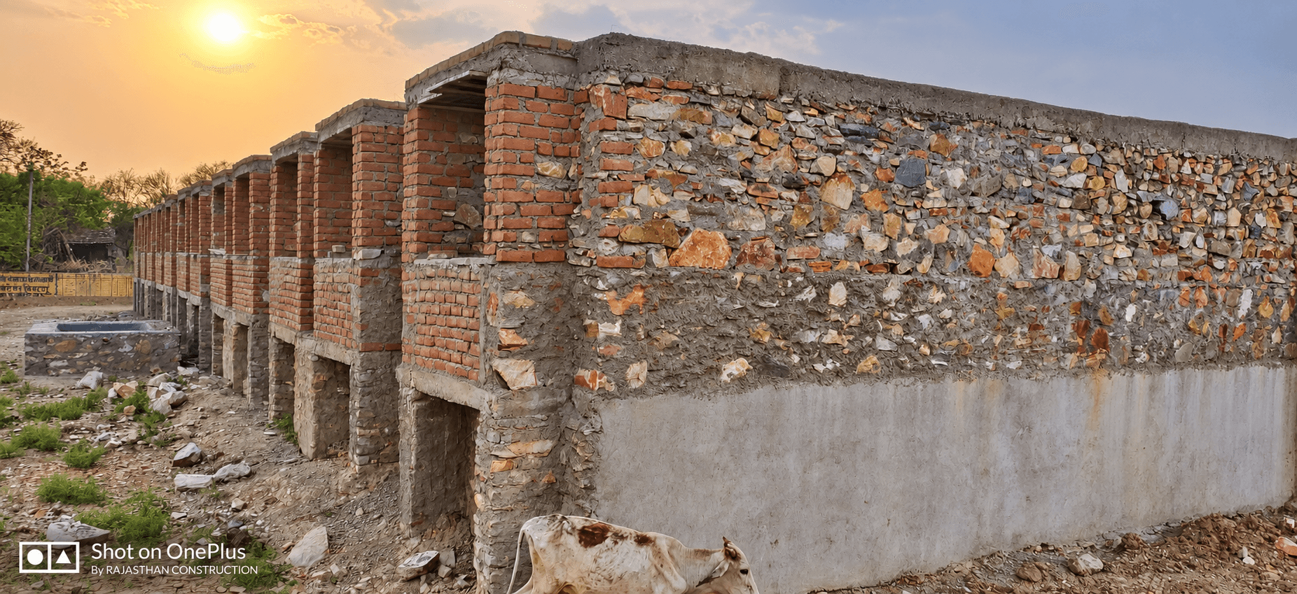
Govt. School Jadana
Project management consultancy for the 5,000 sq.ft. Govt. School Jadana project in Chittorgarh, covering site supervision, quality checks, and progress coordination. Completed 15 December 2022.
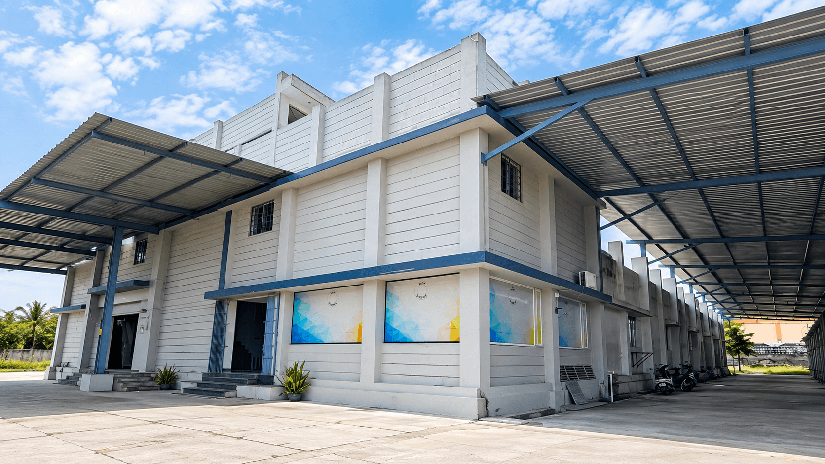
Expansion of Weaving Department (Airjet) – Ajay Syntex Pvt. Ltd.
Expansion of Ajay Syntex Pvt. Ltd.’s airjet weaving department at Guwardi, Bhilwara, covering 25,000 sq.ft. and delivered through project management & consultancy services.
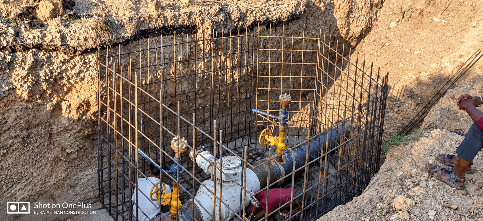
Adani Gas Chamber
Construction of an Adani Gas Chamber at Shinghpur, Chittorgarh, carried out from 16 September 2022 to 18 January 2023.
Planning a project under Surveying & Site Measurements?
Our civil engineers and project managers can conduct an initial site assessment and provide a detailed structural quote.
Frequently Asked Questions
Key technical details and execution guidelines regarding our surveying & site measurements services.
Q1.Why is a digital Total Station survey necessary before building?
A digital survey reveals exact boundary lengths, corner angles, and elevation slopes. Without it, architects cannot plan accurate foundations, and contractors cannot calculate true earthwork excavation costs, often leading to costly disputes.
Q2.What instruments does HiPRO use for land measurements?
Our survey teams utilize electronic Total Station instruments, digital optical levels, and high-precision GPS positioning equipment to record millimeter-accurate angles, distances, and elevations.
Q3.How long does it take to survey a standard residential plot?
Field measurements for a standard residential or commercial plot are typically completed in a single day, with processed CAD contour maps and boundary drawings delivered within 24 to 48 hours.
Q4.Can HiPRO calculate soil excavation volumes for basement work?
Yes. By conducting pre-excavation and post-excavation level surveys, our team generates digital 3D terrain models that calculate the exact volume of soil removed, providing transparent documentation for contractor settlement.
Need Expert Assistance with Surveying & Site Measurements?
Our engineering and technical teams are ready to mobilize across Bhilwara and Rajasthan. Contact us today for a comprehensive consultation and project estimate.
Explore Complementary Engineering Capabilities